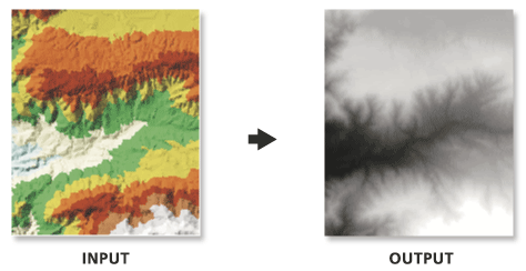
Creates a raster by interpolating its cell values from the elevation of the input TIN at the specified sampling distance.
Illustration
 |
Usage
- Because interpolation of the input TIN surface occurs at regular intervals, some loss of information in the output raster should be expected. How well the raster represents the TIN is dependent on the resolution of the raster and the degree and interval of TIN surface variation. Generally, as the resolution is increased, the output raster more closely represents the TIN surface. Because the raster is a cell structure, it cannot maintain the hard and soft breakline edges that may be present in the TIN.
- You can accept the TIN's XMIN, YMIN as the default origin and the XMAX, YMAX as the upper right corner of the extent to generate a raster covering the full extent of the TIN. Alternatively, you can specify the output raster's origin, extent, and resolution or cell spacing to create a raster covering only a portion of the TIN.
- When exporting a large raster, consider specifying the Output Data Type as an integer to save on disk space if the accuracy requirements of your z-values are such that they can be represented by integer data.
- The output raster may be file based or created as a raster dataset in a geodatabase. Supported file-based formats include Esri Grid, ERDAS IMAGINE, and TIFF. The format is determined based on the output name. If the output path references a geodatabase, a geodatabase raster will be created. If the output resides in a normal file folder and does not include a file extension, an Esri Grid will be produced. Use of the extensions .img and .tif will produce IMAGINE or TIFF files.


0 commentaires